Shopping Cart


Carta’s Illustrated Calendar Of Biblical Times 3000 B.C. – A.D. 150
By: Carta This colorful and instructive classroom aid follows all major regions, kingdoms and events, chronologically, of the ancient world. Heavily illustrated with pictures, artifacts, and an illuminating strip of maps of the important empires of the times. A detailed section of events of the Biblical world. Suitable for all ages. Also features comparative maps of the Holy Land within the empires of Egypt, Assyria, Persia, and Rome.
Language: English
Laminated
9.75 x 13.5 in. (24.5 x 34.5 cm) folds out to 28 x 40 in. (70 x 100 cm)
ISBN: 965-220-572-9 Weight: 180 g (6.3 oz.)
$19.95
More Products
-

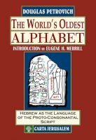
A-Dventure-Z
$22.50 Add to cartThe Story of the Alphabet For children and parents alike, this book includes a charming tale, that shows the main stages leading to the invention of the alphabet. Each letter of the alphabet has an informative text and is accompanied by a full-page color illustration. -
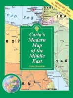
Carta’s Modern Map Of The Middle East – Wall Map
$19.95 Add to cartClearly presented colorful map of the Middle East showing major roads, railways and towns. – Alongside the map are vignettes of valuable information on each country in the Middle East. – Inset of world map showing area of the Middle East.
Reviews
There are no reviews yet.