Shopping Cart

Carta’s Map Of Jerusalem
By: Carta Jerusalem On back: map of the Old City, list of sites and institutions, general information, and index to street names. Language: English Scale: 1:17,000 24x35½ in. (60x90 cm), folds to 5¼x9¼ in. (13½ x 23½ cm)
$10.95
More Products
-

Israel National Parks & Nature Reserves
$35.00 Add to cartA Carta Guide – This colorful and informative Guide is designed to assist hikers and visitors in enjoying the natural landscape and the historical sites of each Park and Nature Reserve. Israel is blessed with panoramic landscapes, hundreds of historical sites
-

Ein Gedi – Oasis And Refuge
$25.00 Add to cartA Carta Field Guide The abundance of fresh water always drew people to Ein Gedi, the largest oasis on the western side of the Dead Sea.
-
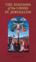
The Stations Of The Cross In Jerusalem
$14.95 Add to cartIntroduction by M. J. Dubois, O.P. This luxuriously illustrated volume is intended for pilgrims and visitors to Jerusalem, the Way of the Cross – the Via Dolorosa, and the 14 Stations of the Cross. It is an intelligible account of the origin, meaning and development of this pious practice.
Reviews
There are no reviews yet.