Shopping Cart


Carta’s Modern Map Of The Middle East – Wall Map
By: Carta Jerusalem Clearly presented colorful map of the Middle East showing major roads, railways and towns. - Alongside the map are vignettes of valuable information on each country in the Middle East. - Inset of world map showing area of the Middle East. Language: English - Folded: 9¾×13½ in. (24.5×34.5 cm) - Folds out to 27½×39 in. (70×100 cm) - Case: 10½×14 in. (27×35.5 cm) Featuring: Laminated Wall Map ISBN: 965-220-631-8 Weight: 180g (6.35 oz)
$19.95
More Products
-
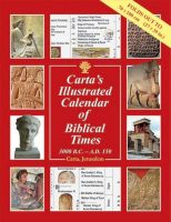
Carta’s Illustrated Calendar Of Biblical Times 3000 B.C. – A.D. 150
$19.95 Add to cartThis colorful and instructive classroom aid follows all major regions, kingdoms and events, chronologically, of the ancient world.
-

Israel National Parks & Nature Reserves
$35.00 Add to cartA Carta Guide – This colorful and informative Guide is designed to assist hikers and visitors in enjoying the natural landscape and the historical sites of each Park and Nature Reserve. Israel is blessed with panoramic landscapes, hundreds of historical sites


Reviews
There are no reviews yet.