Shopping Cart


Carta’s Modern Map Of The Middle East – Wall Map
By: Carta Jerusalem Clearly presented colorful map of the Middle East showing major roads, railways and towns. - Alongside the map are vignettes of valuable information on each country in the Middle East. - Inset of world map showing area of the Middle East. Language: English - Folded: 9¾×13½ in. (24.5×34.5 cm) - Folds out to 27½×39 in. (70×100 cm) - Case: 10½×14 in. (27×35.5 cm) Featuring: Laminated Wall Map ISBN: 965-220-631-8 Weight: 180g (6.35 oz)
$19.95
More Products
-
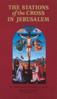
The Stations Of The Cross In Jerusalem
$14.95 Add to cartIntroduction by M. J. Dubois, O.P. This luxuriously illustrated volume is intended for pilgrims and visitors to Jerusalem, the Way of the Cross – the Via Dolorosa, and the 14 Stations of the Cross. It is an intelligible account of the origin, meaning and development of this pious practice.
-

The River Jordan
$14.95 Add to cartAn Illustrated Guide from Bible Days to the Present The River Jordan, the largest and most important river in the Holy Land, has been of great importance, both historically and religiously, throughout the ages.
Reviews
There are no reviews yet.