By: Carta Jerusalem Language: English Print size: 2.94x2.89 in (7.5x7.3 cm) 150 dpi - 154 kB For your personal use only Watermarks will not appear in downloaded maps. For commercial and any other application please Contact Us
$7.99
This revised and newly published book covers the historical geography of the Holy Land from 536 B.C. to A.D. 640. Part I deals in chronological order with the historical factors which have affected the map of the Holy Land during this period.
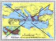
An Introductory Atlas & Comparative View Though centered in the southern Levant, the actual world of the Bible is much larger, stretching across the ancient Near East and filling the eastern Mediterranean Basin.
A set of full-size sheets of 12 maps and plans covering the whole Bible epoch. Specially designed as a teacher’s aid, it can be used in conjunction with Atlas of the Bible which is free with this package.
A set of 10 full-size sheets with 14 maps (28 x 40 in.) covering every aspect of JESUS AND THE APOSTLES. Specially designed as a teacher’s aid, these wall maps can be used in conjunction with our handbook, Jesus and the Apostles. which is free with this package. **** NEW *****
contact us
Reviews
There are no reviews yet.