
Shopping Cart
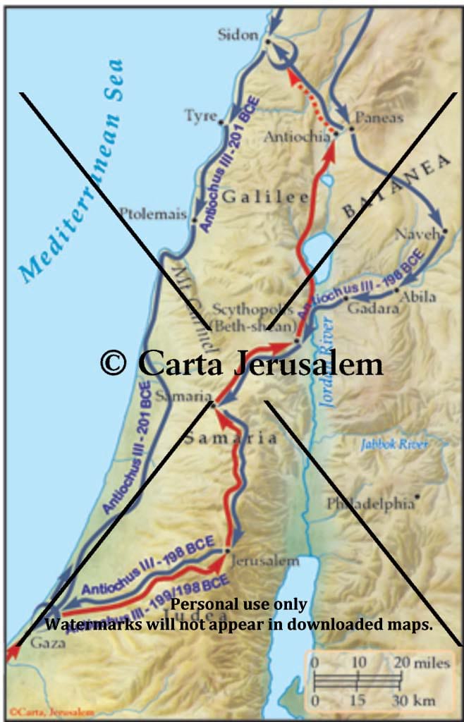
Fifth Syrian War: The Final Conquest Of Palestine By Antiochus III, 201-198 BCE
By: Carta Jerusalem Language: English Print size: 2.84x4.42 in (7.2x11.2 cm) 150 dpi - 285 kB For your personal use only Watermarks will not appear in downloaded maps. For commercial and any other application please Contact Us
$7.99
More Products
-

The Holy Land – A Historical Geography From The Persian To The Arab Conquest 536B.C. To A.D.640
$25.00 Add to cartThis revised and newly published book covers the historical geography of the Holy Land from 536 B.C. to A.D. 640. Part I deals in chronological order with the historical factors which have affected the map of the Holy Land during this period.
-

Illustrated Wall Maps Of The Bible
$45.00 Add to cartA set of full-size sheets of 12 maps and plans covering the whole Bible epoch. Specially designed as a teacher’s aid, it can be used in conjunction with Atlas of the Bible which is free with this package.
-

Carta’s Illustrated Bible Atlas , With Historical Notes
$13.95 Add to cartFrom the Second Millennium B.C. to the First Century A.D., this compact and lavishly illustrated Bible Atlas, with its many maps, illuminates the biblical period and provides the reader with a visual background to the beauty of the Holy Scriptures. Now revised, it will serve another generation in gaining a better image of the Holy Writ.
Reviews
There are no reviews yet.